What is Geographic Information Science (GIScience)? In a nutshell, GIScience is about using mapped data to solve problems and make better decisions.
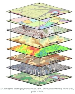
Geospatial Information Science (GIScience) is a field of inquiry utilizing computer technology for presentation and analysis of all types of natural science and social science data referenced to the earth’s surface. GIScience uses an infinite variety of mapped data, aerial photographs, digital elevation models, satellite imagery, and more to solve problems and answer questions. At Marshall, you’ll have the opportunity to learn GIScience using the latest tools including GPS/GNSS, UAVs/drones, ArcGIS software, R, QGIS, and others.
Among academic fields, Geography (as an earth science and a social science), Environmental Sciences, Geology, History, Archaeology, Engineering, Planning, Political Science, Criminal Justice, Natural Resources Management, and Demographics are but a sampling of fields that utilize GIScience technologies. In fact, it has been estimated that about 80% of all data has a spatial component, opening limitless potential uses for GIScience.
Learn all about Careers in GIS. At Marshall, students in Biology, Environmental Science, Geography, Computer Science, Geology, Health Informatics, Forensics, etc. get certificates in GIScience to advance their career opportunities.
About our GIScience Programs
Marshall University GIScience offers a bachelor’s in Geography with an area of emphasis in GIScience, an interdisciplinary Undergraduate Minor or Certificate program. The GIScience program also offers a Graduate Certificate in Geospatial Information Science.
Choose an Undergraduate GIScience Program:
Undergraduate Minor or Certificate in GIScience
Choose a Graduate GIScience Program:
Graduate Certificate in GIScience
The GIScience Programs are designed to:
- offer GIS study in a variety of disciplines with a variety of applications;
- teach students GIS techniques;
- encourage students to apply GIS to solve scientific research problems;
- encourage students to gain experience in the GIS field before graduation by means of internships and work study programs;
- integrate GIS applications with appropriate computer science training;
- prepare students for GIS employment or GIS work at the graduate level.
GIScience career preparation
If you are interested in becoming a GIS analyst, there are several steps you can take to achieve this career goal. GIS, or geographic information system, is a rapidly growing field that involves the use of computer software to collect, analyze, and interpret spatial data.
To become a GIS analyst, you should start by earning a degree in geography or a related field. A geography degree provides students with a broad understanding of the earth’s physical and cultural systems, as well as the methods used to analyze and represent spatial data. This foundation is critical to developing the necessary skills for a career in GIS analysis.
After obtaining a degree, you should consider pursuing additional training or certification in GIS software and techniques. Marshall offer GIS courses and access to online resources such as Esri’s ArcGIS tutorials to provide hands-on experience with industry-standard software.
Internships and entry-level jobs can also provide valuable experience and help you build a professional network. You can seek opportunities with government agencies, consulting firms, or private companies that use GIS analysis in their operations.
In addition to technical skills, GIS analysts also need strong communication and problem-solving abilities. You must be able to translate technical information into understandable language and work collaboratively with colleagues and clients.