Severe Storms Roll Through West Virginia with More Rain to Come | Emily’s Weather Corner

Emily’s Weather Corner
Emily Grady
Thursday, May 21, 2026
Severe storms rolled through central West Virginia on the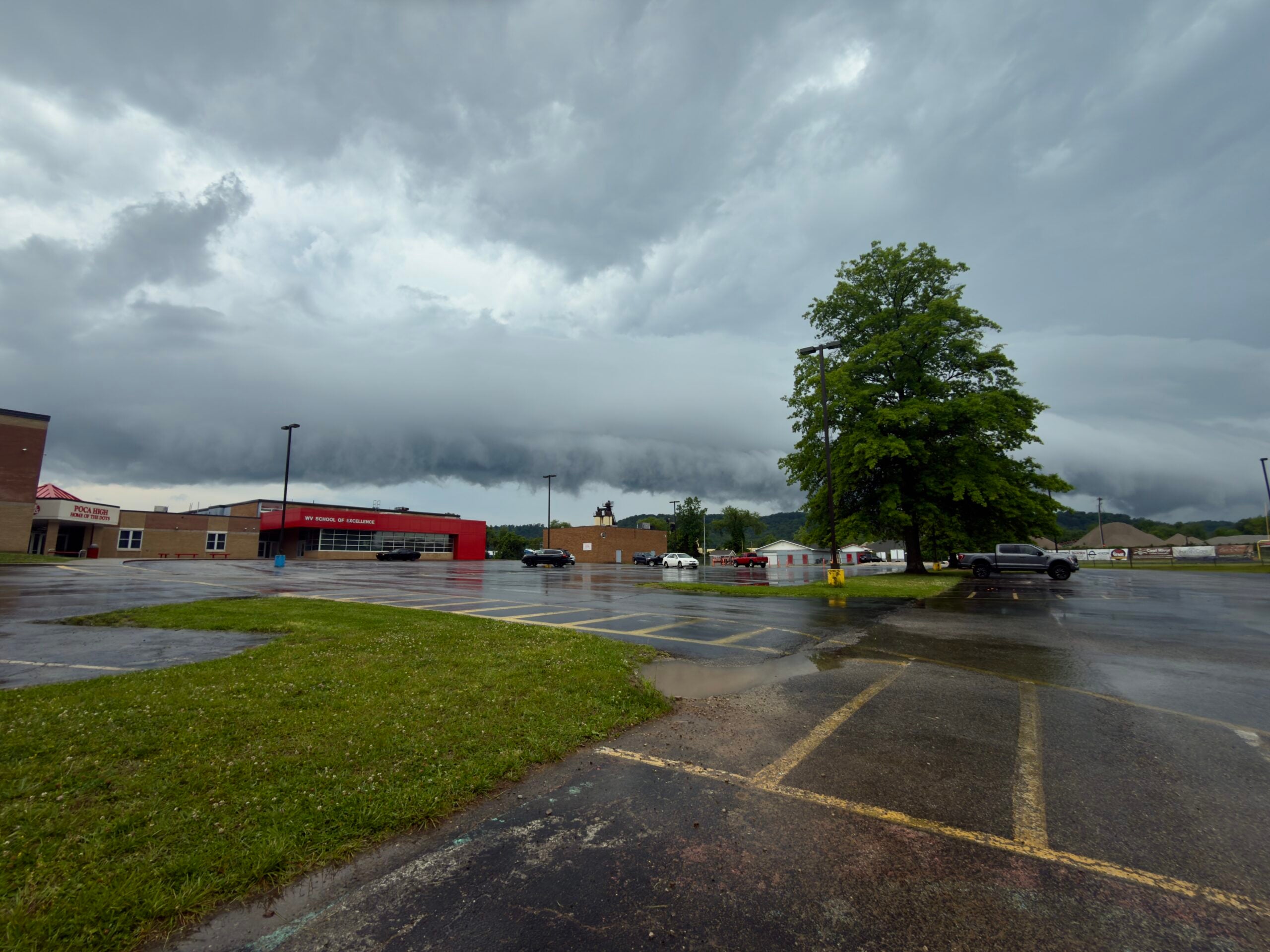 afternoon of May 20, 2026, dropping quarter sized hail and gusty winds.
The storms came in early in comparison to when preliminary forecasts had placed them, garnering a severe thunderstorm watch from the Storm Prediction Center, who had previously placed the area under a slight risk for severe storms in the daily outlook earlier in the day. The earliness of the storms was in tandem with the dismissals of schools and some workplaces. The most severe cells tracked through Cabell, southern Putnam, Kanawha, and Clay counties, before weakening.
The storms came through in waves, one after the other, across roughly the same paths. The first of the cells even strengthened to warrant a tornado warning shortly after crossing into Kanawha County after becoming an ‘elevated supercell’, or a type of strong, rotating thunderstorm that sits on top of stable surface air, feeding off of that air rather than warm air from the ground. It is unconfirmed if a tornado was produced from the storm at this time. Storm damages reported to the National Weather Service, however, were minimal, with the only reports being trees down on power lines— specifically, one in Poca, which blocked a school bus from getting to its route. However, there were several reports within the tracks of these storms of hail ranging from quarter to half-dollar sizes. No damage to vehicles was reported.
Rain continues through much of the area for the rest of the week into next week, with thunderstorm chances returning for this weekend.
The forecast for the rest of the week places today with a high of 60 and low of 56, Friday with a high of 68 and low of 60, Saturday with a high of 75, low of 61, and Sunday with a high of 79, low of 62.
For more information or to report further storm damage, please visit https://www.weather.gov/rlx.