– Dr. Mike Caudill, Dept. of Geology, Marshall University
According to the West Virginia Groundwater Resource Act, Article 12, Chapter 22 of the West Virginia Code, groundwater is the source of drinking water for more than 50% of the state’s total population and more than 90% of the rural population. Students in Marshall University’s Hydrogeology course learn how geology controls the distribution and abundance of groundwater across the state.
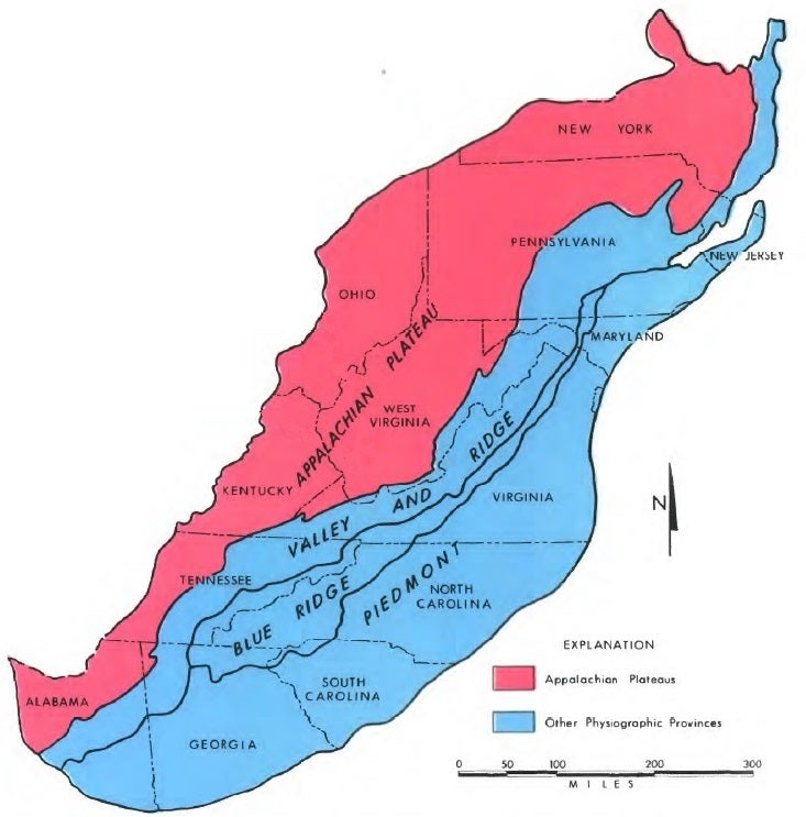
Most of West Virginia lies in the Appalachian Plateau region of the Appalachian Mountains (Fig. 1). This region of hills and valleys has been configured by the erosional downcutting to streams, which have carved an abundance of deep valleys across a region that otherwise would have been a relatively flat platform.
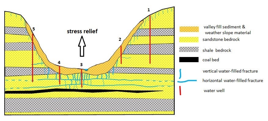
When streams begin to carve valleys, they do so where the bedrock is the weakest. Valley floors that lie several hundred feet below ridgetops exist because streams have removed several hundred feet of bedrock that once occupied the valley. Erosional removal of this bedrock relieves the stress (i.e., weight/pressure) on the remaining rock beneath the valley floor. After, and perhaps during, the “stress relief” that accompanies carving of a stream valley, the underlying bedrock adjusts to new low stress conditions by relaxing.
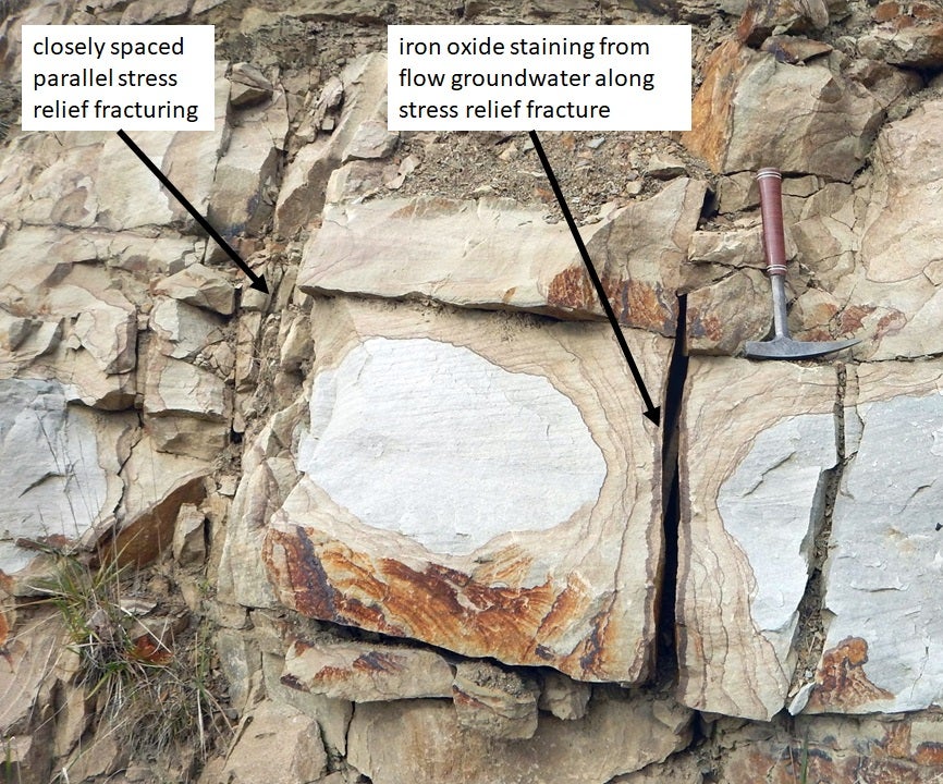
“Stress relief” that results from erosional removal of the bedrock layers in the valleys of the Appalachian Plateau has fractured the bedrock of the valley walls and beneath the valley floors. This relaxation proceeds via sporadic and subtle expansion of the bedrock in the valley walls and beneath the valley floors. Expansion entails cracking and fracturing of bedrock as stress derived from overlying rock is removed by valley erosion. These fractures include more-or-less vertical fractures extending downward into the bedrock (Fig.2). In addition, the horizontal layers or beds of sedimentary bedrock that underlie the Plateau, split apart along layer boundaries, which forms horizonal fractures between layers. Such fractures are best formed under the deepest part of the valley where the greatest thickness of bedrock and thus the most stress have been removed. In addition to horizontal fracturing, bedrock beneath the deepest part of the valley may subtly bend upward in response to stress relief forming “stream anticlines”. The bedrock is brittle, and as a result, additional vertical fractures are formed as the rock arches upward. All these processes together produce; 1) vertical fractures along valley walls and valley bottoms, 2) horizontal fractures beneath valley bottoms, and 3) additional vertical fractures formed by stream anticlines beneath the deepest parts of valleys.
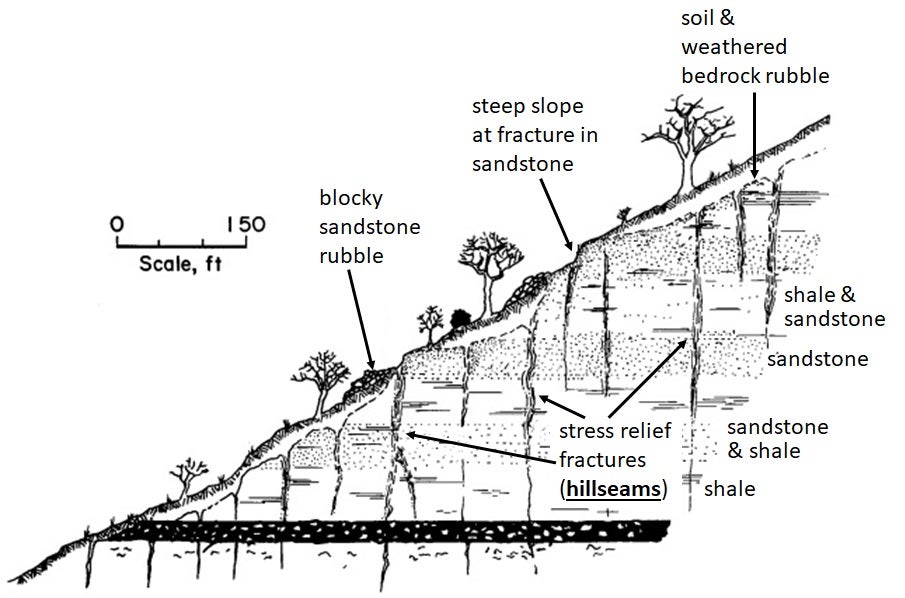
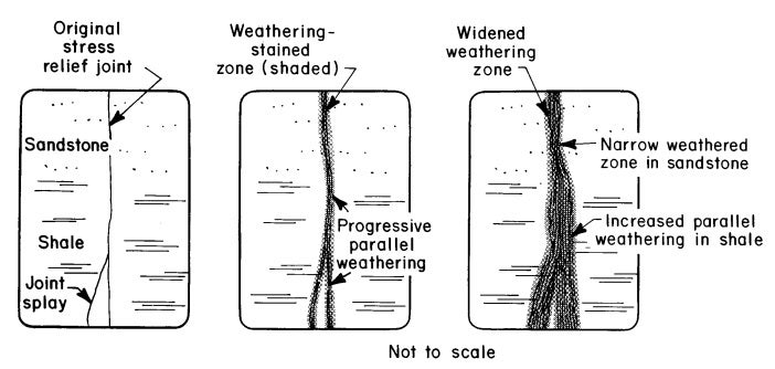
Highly weathered stress relief fractures formed by valley unloading are known as “hillseams” (Figs. 3 & 4). Where underground coal mines extend beneath stream valleys, hillseams (i.e., weathered stress relief fractures) in the rock above the mine cavity can make the roof dangerously unstable and contribute to roof falls. Hillseams can be seen in many road cut exposures along major highways on the Appalachian Plateau (Fig. 5).
How are stress fractures (hillseams) related to water wells on the Appalachian Plateau? Groundwater flow in this region is mainly controlled by gently sloping layers of stacked sedimentary rocks (shale, sandstone, and coal) and the stress relief fractures they contain (Kozar, et al., 2012). If you drill a water well in the Plateau region of West Virginia, in any area other than the major river valleys (i.e., Ohio and Kanawha Rivers), most of the water flowing into the well will be flowing from “stress relief” fractures in the stacked bedrock layers (Fig. 6). In contrast, major river valleys like the Ohio and Kanawha are sites where high-volume water wells are supplied by flow from relatively thick (~60- 100ft) sand and gravel deposits beneath the valley floor. Smaller stream valleys, however, lack sufficient thickness of sand and gravel deposits to supply much water. Another exception to groundwater flow from “stress relief” fractures, are wells supplied by flow from the caved and subsided areas of underground coal mines. Here flow is from fractures, but these fractures are not the result of stream valley erosion, but rather collapsing deep mines.
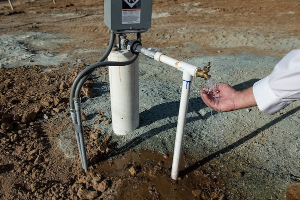
/media/DWR-Images/Placeholder-images/news/KMG_water_well_34252.jpg. Accessed 4/9/2021.
Sources
Kentucky Geological Survey. https://www.uky.edu/KGS/coal/coal-mining-geology- fracture-stress-release.php. Accessed 4/2/2021.
Kozar, M.D., McCoy, K.J., Britton, J.Q., and Bascombe M. Blake, Jr., 2012, Hydrogeology, Groundwater Flow, and Groundwater Quality of an Abandoned Underground Coal-Mine Aquifer, Elkhorn Area West Virginia: Morgantown, West Virginia, West Virginia Geological and Economic Survey, Bulletin Number B-46, 103 pp
Sames, G.P. and Moebs, N.N. 1992. Roof control of stress-relief jointing near outcrop in Central Appalachian drift coal mines, U.S. Bureau of Mines IC 9313, 11 pp.
WVA Code. http://www.wvlegislature.gov/wvcode/code.cfm?chap=22&art=12#:~:text=
%281%29%20West%20Virginia%20has%20relatively%20pure%20groundwater%20 resources,rural%20population%2C%20depend%20on%20groundwater%20for%20drink ing%20water%3B. Accessed 4/3/2021.
Wyrick, G.G., and Borchers, J.W., 1981, Hydrologic effects of stress relief fracturing in an Appalachian valley: U.S. Geological Survey Water-Supply Paper 2177, 51 p.